Hawaii braces for Hurricane Lowell as an unusually stormy Pacific raises the stakes
Hawaii braces for Hurricane Lowell as an unusually stormy Pacific raises the stakes
Hawaii is preparing for Hurricane Lowell under a deceptively narrow margin of safety: the storm’s projected path keeps its core winds offshore, but the islands remain exposed to dangerous rain, surf and flooding.
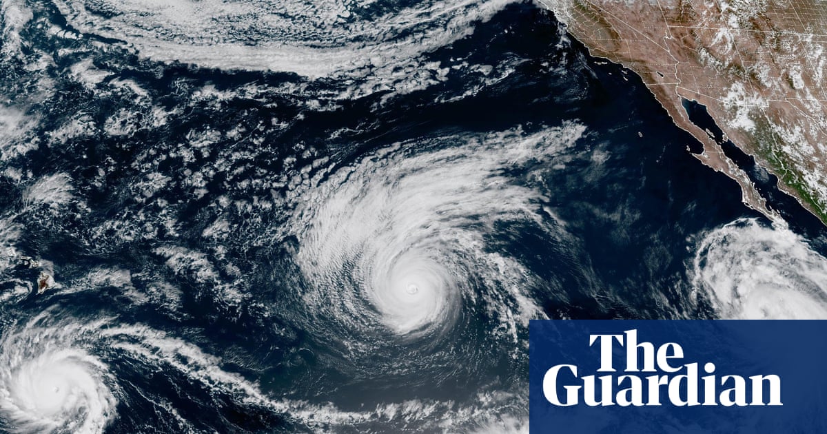
The emergency declaration comes as Lowell, still a Category 3 hurricane with winds of 125 mph, moves northwest toward Hawaii. Forecasts suggest it will weaken to Category 2 before passing roughly 130 miles west of Ni’ihau or 170 miles west of Kauai between Monday evening and Tuesday morning. Kauai and Ni’ihau face tropical-storm-force gusts, while heavy rain and mudslides remain significant threats. The storm’s expected offshore passage therefore reduces, but does not remove, the danger.
The broader concern is repetition. Lowell is the third storm to threaten Hawaii in just over three weeks, following Hurricane Lala and Tropical Storm Moke. The same account frames that sequence within unusually active Pacific conditions: three hurricanes—Karina, Lowell and Marie—were churning simultaneously, while forecasters monitored another possible system near Mexico. It also links the heightened risk to a strengthening El Niño and the climate crisis, arguing that storms and other extreme-weather events are becoming more intense and frequent.
The conservative framing is narrower and more immediate. Its headline tells residents to expect “tropical storm conditions” as Lowell passes west, emphasizing the storm’s distance from the islands rather than the wider climate or regional pattern. Both perspectives point to the same near-term reality: Hawaii may avoid a direct hurricane strike, but an offshore track can still bring damaging weather. They diverge mainly over what the event signifies—an urgent, localized hazard or another warning about a changing Pacific climate.
Write a comment