Google’s Google Earth AI blew up because the map itself was too easy to fake
Google’s Google Earth AI blew up because the map itself was too easy to fake
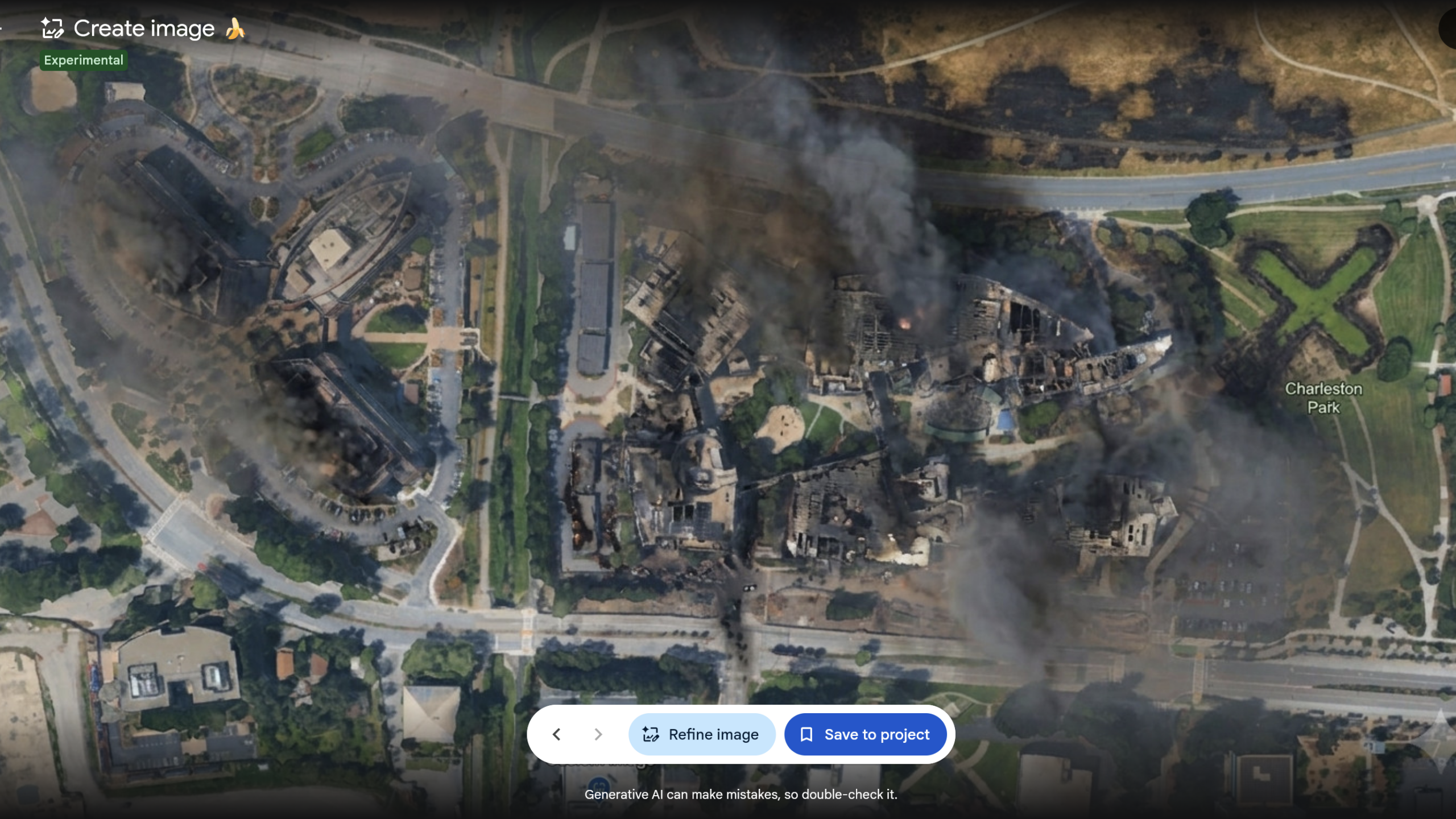
Google tried to turn Earth into a playground for AI image editing. Within a day, it ran straight into a simpler reality: people still treat Google Earth as evidence, and that makes fakery far more dangerous there than in a generic image app.
The feature, powered by Nano Banana 2, let users generate altered images from Google Earth’s satellite, aerial, and 3D imagery. Google pitched it as a creative and practical tool — a way to “reimagine locations,” preview projects, or even visualize how a place looked in the past. That upbeat case also showed up in GoogleAI’s launch messaging, which asked: “What if you could see a city as it looked 100 years ago, or visualize a new basketball court at your local community center?”
But the backlash was immediate because Google Earth is not just another canvas. Journalists, researchers and open-source investigators use it to verify images, videos and events in the real world. That is why critics saw the tool less as a novelty than as a credibility bomb. As Ars Technica put it, Google had made it easier to create “modified versions of authentic imagery depicting real locations.”
Examples quickly sharpened the concern. The Verge reported that researcher Henk van Ess generated scenes showing “refugees near the Mexican border” and “a bomb crater near a hospital in Gaza,” underscoring how plausible falsehoods could be dressed up as satellite truth. Another Verge report said van Ess found that “Nothing was refused, nothing was softened, and nothing suggested I try a different prompt.”
Google initially leaned on watermarking, saying every image included SynthID. Then it changed course. In its rollback statement, the company said, “We know that people uniquely trust Google Earth for a reliable view of the world,” adding that while some professionals found useful applications, others were sharing generated imagery that appeared to break policy, so Google was “implementing stronger guardrails.”
That is the real lesson here: AI fakery is everywhere, but embedding it inside one of the web’s most trusted visual reference tools crossed a line Google itself had to acknowledge.
Continue reading https://foxvector.com/stories/019fbb57-bc06-29c5-71ac-2ad84a3050d6
Write a comment