Hurricane Lowell’s Late Turn Puts Kauai in the Crosshairs
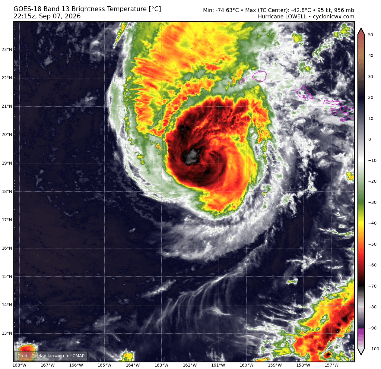
Hurricane Lowell’s Late Turn Puts Kauai in the Crosshairs
On Thursday, Lowell was still a Category 4 hurricane, packing sustained winds of 140 mph after a burst of intensification that had briefly made it a Category 5. Forecast models agreed it would swing north toward Hawaii, but the timing of that turn — shaped by the remnants of Hurricane Karina and a North Pacific trough — left open the difference between a near miss and a direct strike.
The National Hurricane Center warned then that Lowell was “still forecast to be at or near major hurricane strength when making its closest approach to the Hawaiian Islands.” Reconnaissance flights and new model data were expected to narrow the uncertainty, while the prospect of hurricane watches underscored how quickly a distant Pacific storm had become Hawaii’s problem.
By Monday evening, the uncertainty had narrowed in the most unsettling direction. Lowell had weakened to Category 2 status, with 110-mph sustained winds, but accelerated north-northeast and sat about 170 miles southwest of Lihue. Its northward turn came later than anticipated, shifting the projected track closer to Kauai and Niihau.
The consequence was a cascade of warnings: hurricane conditions, 4 to 8 inches of rain with isolated totals of 12 inches, possible flooding and mudslides, and surf expected to build from 7-to-10-foot waves to 20-to-30-foot breakers. Offshore seas could peak between 30 and 50 feet.
Hawaii also issued its first-ever tornado watch, covering Kauai and Niihau through early Tuesday. Governor Josh Green ordered Kauai’s schools and state and county offices closed, while travelers queued at Lihue Airport and scattered power outages hit Wailua.
Kauai Mayor Derek Kawakami captured the shift from forecast anxiety to immediate danger: “Over the past 24 hours we have watched this system veer closer to us, too close for comfort.” His instruction was blunt: finish preparations, get off the roads and be indoors by midday.
Continue reading https://foxvector.com/stories/01a085fa-74c9-292d-714b-3e2c253cde1e
Write a comment